
 Đánh giá nguy cơ tổn thương đới bờ tỉnh Thừa Thiên Huế dưới ảnh hưởng của nước biển dâng
Title: ASSESSMENT OF RISK OF COASTAL ZONE IN THUA THIEN HUE DUE TO THE INFLUENCE OF SEA LEVEL RISE Abstract: Using the index lesion coast Coastal Vulnerability Index (CVI) combined with remote sensing and GIS tools, is one of the effective methods to assess, identified coastal vulnerability Thua Thien Hue province. The study results show that: ...
 10 trang | Chia sẻ: yendt2356 | Ngày: 27/11/2020 | Lượt xem: 505 | Lượt tải: 0
 Đặc điểm thạch học và ranh giới trên đá vôi permi muôṇ trong măṭ cắt điạ chất taị mo ong khai thác ở Tân Hoà , Tân Châu, Tây Ninh, Viêṭ Nam
In the South – Eastern region, Vietnam, the stratigraphic boundary of Late Permian - Early Triassic has long been considered as an unconformity boundary between Ta Vat formation (Late Permian) and Song Saigon formation (Early Triassic). Recent studies on the petrographic and geological structure of this section suggested that it may be a co...
9 trang | Chia sẻ: huongnt365 | Ngày: 27/11/2020 | Lượt xem: 551 | Lượt tải: 0 Đặc điểm thuộc tính địa kỹ thuật của trầm tích pleistocene muộn-Holocene tại khu vực Cao Lãnh - Đồng Tháp
Sediments of the Mekong Delta in general and Cao Lanh-Dong Thap in particular is quite complex, including multiple units of different sedimentary petrography. The units have different mechanical and physical properties therefore they affect the stability of the above structures. This paper discusses about the sedimentary structure, the mech...
14 trang | Chia sẻ: huongnt365 | Ngày: 27/11/2020 | Lượt xem: 499 | Lượt tải: 0 Sử dụng phương pháp dự án trong giáo dục phòng chống thiên tai ở môn Địa lí lớp 12
Title: PROJECT METHODOLOGY APPLIED IN DISASTER PREVENTION EDUCATION IN GEOGRAPHY SUBJECTS 12 GRADE Abstract: Essential content articles study the possibility of applying methods of projects in disaster prevention education in geography subjects 12 grade. Simultaneously, define processes, engineering and application to design an activity form of...
11 trang | Chia sẻ: yendt2356 | Ngày: 27/11/2020 | Lượt xem: 587 | Lượt tải: 0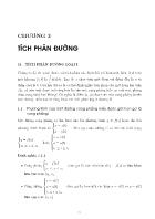 Giáo trình toán cao cap A2 - Chương 3: Tích phâ đường
Bài 4.7. Tính ff xyzdxdy vói s là phía ngoài của một phần tư mặt cầu x24-y24-22 = l,x > 0,ỉ/ > 0. Bài 4.8. Tính ỊỊ xdydz 4- dxdz 4- xz2dxdy vói s là phía ngoài cùa một phần tám 8 mặt cầu X2 4- ý2 4- z2 = 1, X > 0. y > 0. z > 0. Bài 4.9. Tính ff x2y2zdxdy vói s là mặt phía trên cùa nửa mặt cầu X2 + ý2 4- z2 = $ /?2.2<0. Bài 4.10. Tính ỈỊ = ff z...
27 trang | Chia sẻ: thucuc2301 | Ngày: 27/11/2020 | Lượt xem: 1197 | Lượt tải: 0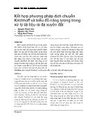 Kết hợp phương pháp dịch chuyển Kirchhoff và biểu đồ năng lượng trong xử lý tài liệu ra đa xuyên đất
Kirchhoff migration in ground penetrating radar (GPR) has been the technique of collapsing diffraction events on unmigrated records to points, thus moving reflection events to their proper locations and creating a true image of subsurface structures. Today, the scope of Kirchhoff migration has been broadened and is a tool for electromagneti...
9 trang | Chia sẻ: huongnt365 | Ngày: 27/11/2020 | Lượt xem: 583 | Lượt tải: 0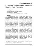 A Modified Semi-Parametric Regression Model For Flood Forecasting
Trong những năm gần đây, lũ lụt, một trong các hiện tượng thiên tai, xảy ra ngày càng nhiều và khắc nghiệt. Hàng năm, con người luôn phải gánh chịu hậu quả do lũ lụt gây ra. Bởi thế, việc phát triển các phương pháp quản lý nhằm giúp cho ta xác định, phân tích, mô hình, và dự báo lũ lụt là việc làm hết sức cấp bách và cần thiết. Trong phạm v...
11 trang | Chia sẻ: huongnt365 | Ngày: 27/11/2020 | Lượt xem: 532 | Lượt tải: 0 Thành lập bản đồ sinh khí hậu tỉnh Đồng Nai, tỉ lệ 1:100.000
Title: SETTING UP DONG NAI’S BIOCLIMATIC MAP SCALE 1/100.000 Abstract: The article refers to the process of climate mapping born with these principles, the system targets mainly related to temperature - humidity with its own characteristics. The study results were split on climate mapping born in Dong Nai province has 35 small area of the 15 ty...
7 trang | Chia sẻ: yendt2356 | Ngày: 27/11/2020 | Lượt xem: 532 | Lượt tải: 0 Bài giảng Toán tổ hợp - Chương 4: Đại cương về đồ thị - ĐH KHTN TP.HCM
Liên thông mạnh Định nghĩa. Cho đồ thị có hướng G = (VE). Trên V ta định nghĩa quan hệ tương đương như sau: u~e ⇔ u = v hay có một đường đi từ 1 đến y và đường đi từ v đến u . a) Nếu ucv thì ta nói hai đỉnh u và v liên thông mạnh với nhau . b) Mỗi lớp tương đương được gọi là một thành phần liên thông mạnh của G. c) Nếu G chỉ có một thành phầ...
67 trang | Chia sẻ: hoant3298 | Ngày: 27/11/2020 | Lượt xem: 539 | Lượt tải: 0 Đề xuất thuật toán giảm tích lũy dòng chảy ứng dụng trong công tác giảm ngập
Flooding is a serious urban problem, especially in HoChiMinh city in recent years. Many researches for flow accumulation by terrain have been proposed. Accordingly, terrains are splitted to grids. Single or multiflow algorithms will theoretically show the accumulated water trend. So that, to reduce flooding, increasing road or extending drai...
6 trang | Chia sẻ: huongnt365 | Ngày: 27/11/2020 | Lượt xem: 527 | Lượt tải: 0

